Best Geology and Seismic Software
Best Geology and Seismic Software At A Glance
G2 takes pride in showing unbiased reviews on user satisfaction in our ratings and reports. We do not allow paid placements in any of our ratings, rankings, or reports. Learn about our scoring methodologies.
- Overview
- Seller Details
ArcGIS Geostatistical Analyst is an ArcGIS Pro, ArcMap, and ArcGIS Enterprise extension. It is not always possible or practical to predict and model spatial phenomena through real-world observations.
- 40% Small-Business
- 33% Mid-Market
190,003 Twitter followers
- Overview
- Seller Details
Surfer® is a full-function 2D and 3D mapping, modeling, and analysis software package for scientists and engineers. Surfer's sophisticated interpolation engine quickly transforms XYZ and XYZC data int
- Environmental Services
- Oil & Energy
- 53% Small-Business
- 26% Mid-Market
798 Twitter followers
- Overview
- Seller Details
The Petrel E&P software platform brings disciplines together with best-in-class applied science in an unparalleled productivity environment. This shared earth approach enables companies to standar
- Oil & Energy
- 50% Enterprise
- 38% Small-Business
- Overview
- Seller Details
Geoprobe software is 3D multi-volume interpretation and visualization solution, to accelerate interpretation workflows from basin scale through detailed prospect and reservoir analysis.
- Environmental Services
- Oil & Energy
- 45% Enterprise
- 45% Small-Business
62,394 Twitter followers
- Overview
- Seller Details
IHS Kingdom software provides you the functionality needed for your portfolio management from prospect to production, with interpretation to microseismic analysis and geosteering resulting in interpre
- Oil & Energy
- 56% Small-Business
- 33% Mid-Market
- Overview
- Seller Details
PLAXIS 2D is a powerful and user-friendly finite-element package intended for 2D analysis of deformation and stability in geotechnical engineering and rock mechanics. PLAXIS is used worldwide by top
- Civil Engineering
- 58% Small-Business
- 25% Mid-Market
17,634 Twitter followers
- Overview
- Seller Details
As infrastructure assets are crucially linked to subsurface environments, they are vulnerable to geotechnical risk. Perform three-dimensional finite element analysis of deformation and stability in g
- 44% Mid-Market
- 33% Small-Business
17,634 Twitter followers
- Overview
- Seller Details
Geophysics is a seismic interpretation solution with all of the tools you need to interpret conventional and unconventional plays in one comprehensive package. Fully-scalable, large projects can be sh
- Oil & Energy
- 78% Small-Business
- 11% Enterprise
572 Twitter followers
- Overview
- Seller Details
GEOVIA Surpac is a geology and mine planning software that supports open pit and underground operations and exploration projects that helps manage efficiency and accuracy with 3D graphics and workflow
- Mining & Metals
- 45% Mid-Market
- 41% Small-Business
74,503 Twitter followers
- Overview
- Seller Details
Vulcan is a 3D mining software solution that gives you the ability to validate and transform raw mining data into dynamic 3D models, mine designs, and operating plans.
- Mining & Metals
- 58% Mid-Market
- 33% Small-Business
1,382 Twitter followers
- Overview
- Seller Details
MineScape is a suite of integrated solutions for coal and metalliferous deposit open-cut and underground mining operation. It delivers extensive geologic modeling and mine-design functionality.
- 75% Enterprise
- 25% Mid-Market
470 Twitter followers
- Overview
- Seller Details
CPillar is a quick and easy-to-use tool for evaluating the stability of surface or underground crown pillars, and laminated roof beds. CPillar offers three different limit equilibrium analysis method
- 100% Small-Business
2,315 Twitter followers
- Overview
- Seller Details
OpendTect is a seismic interpretation software system for processing, visualizing and interpreting multi-volume seismic data and development of interpretation tools.
- 100% Small-Business
- 33% Mid-Market
105 Twitter followers
- Overview
- Seller Details
DecisionSpace Geosteering is an app designed to help users adapt to drilling changes quickly.
- 100% Mid-Market
62,394 Twitter followers
- Overview
- Seller Details
FLAC3D (Fast Lagrangian Analysis of Continua in 3 Dimensions) is numerical modeling software for geotechnical analyses of soil, rock, groundwater, constructs, and ground support. Such analyses include
- 100% Small-Business
- Overview
- Seller Details
GeoThrust is a 2D/3D surface seismic data analysis system that combines near-surface imaging techniques with subsurface imaging strategies, and presents a powerful solution to earth imaging problems.
- 100% Small-Business
- Overview
- Seller Details
PVI's HYDPRO is a comprehensive drilling hydraulics model that covers all aspects of hydraulics, including downhole circulating pressures, surge and swab, ECD, bit optimization, hole cleaning, and vol
- 100% Small-Business
141 Twitter followers
- Overview
- Seller Details
InSite Seismic Processor is an integrated seismic data acquisition, processing, management and visualization software for seismological studies ranging from Acoustic emissions in lab tests, through mi
- 100% Enterprise
- Overview
- Seller Details
Kingdom is a seismic and geological interpretation software designed to help geoscientists, drillers and engineers to collaborate with each other.
- 100% Small-Business
- Overview
- Seller Details
LEASSV Seismic Vectorising is a software solution for re-vectorising scanned images of seismic sections and outputting the results as a formatted trace file while using the utilities provided to outpu
- 100% Enterprise
58 Twitter followers
- Overview
- Seller Details
MESA offers a offshore 3D program leveraging geological knowledge from BasinSPAN programs to deliver high quality imaging.
- 100% Small-Business
- Overview
- Seller Details
Mud-logging software was initiated by an extensive survey on platforms present in the market and extraction of their advantages and disadvantages.
- 100% Mid-Market
62 Twitter followers
- Overview
- Seller Details
When modeling behaviors of earth materials, you need reliable expertise and software applications that meet slope stability challenges of soil of rock slopes. With PLAXIS LE 2D/3D, you can perform ov
- 50% Small-Business
- 50% Mid-Market
17,634 Twitter followers
- Overview
- Seller Details
RadExPro is a seismic processing software on Windows. It is capable for seismic processing from real-time seismic acquisition QC and in-field processing to final stacks. It is capable for in-depth HR
- 100% Small-Business
- Overview
- Seller Details
RockWorks is the standard in the petroleum, environmental, geotechnical and mining industries for surface and subsurface data visualization, with popular tools such as maps, logs, cross sections, fenc
- 100% Enterprise
152 Twitter followers
- Overview
- Seller Details
StarSteer provides geosteering solutions designed to manage the efficiency of horizontal drilling and provide understanding of reservoir geology.
- 100% Mid-Market
134 Twitter followers
- Overview
- Seller Details
VISTA desktop seismic data processing software provides data processing from early-stage acquisition QC to final processing and interpretation of 2D and 3D seismic data acquired on land or offshore or
- Overview
- Seller Details
AGS Workbench is a powerful platform developed initially at Aarhus University to help protect groundwater resources by modelling the subsurface across Denmark. It is a leading solution for processing,
1,327 Twitter followers
- Overview
- Seller Details
AttributeStudio is an integrated toolkit for 3D seismic attribute generation, visualization, calibration and interpretation that combines rendering technology with analysis tools that allow you to mov
24 Twitter followers
- Overview
- Seller Details
ColchisFM is an advanced seismic forward modeling software that bridges rock physics forward modeling and seismic modeling workflows. It streamlines the process from reservoir parameters to seismic da
- Overview
- Seller Details
COMPASS is an application for directional well path planning, survey data management, and anti-collision analysis designed for oil companies and directional drilling contractors.
62,394 Twitter followers
- Overview
- Seller Details
DataCloud provides solutions that combine hardware, software, and geosciences. Providing both measurements while drilling and real-time rock analysis.
299 Twitter followers
- Overview
- Seller Details
DEPRO is a comprehensive torque, drag and hydraulics program.DEPRO predicts the limits in the length of a horizontal well based on specific friction factors, recommends rig specifications, and evaluat
141 Twitter followers
- Overview
- Seller Details
DeviSoft.Mobile™ is Devico’s PDA software which operates all Devico Borehole Surveying Tools
13 Twitter followers
- Overview
- Seller Details
DrillerDB simplifies water well drilling operations with advanced project management tools. Track projects in real-time, manage data efficiently, and make informed decisions with detailed reports. Exp
- Overview
- Seller Details
DSPGeo Stack 2D allows you to produce stacked seismic sections based on the common reflection surface method, which allows you to manage results over the traditional common midpoint method.
- Overview
- Seller Details
- Overview
- Seller Details
Geotechnical Engineering Modelling Software (GEMS) specializes in feature rich, easy-to-use Computer Aided Design & Engineering (CAD & E) software for foundation design & analysis. GEMS
- Overview
- Seller Details
Genesis Online Reporting System (ORS) is a service which provides petroleum companies with a web-based system that allows for the uploading of Daily Drilling Reports (DDR usually in Excel files) into
- Overview
- Seller Details
Geology by SeisWare places traditional geologic interpretation tools, including tops picking and log correlation, into a dynamic 3D environment. Any changes in interpretation are immediately reflected
572 Twitter followers
- Overview
- Seller Details
Geomodelr is a web geological modeling platform. It helps geologists to model complex geological settings with simple operations.
655 Twitter followers
- Overview
- Seller Details
GeoStreamer provides data for solving seismic imaging challenges with capabilities created value for sub-salt exploration, time-lapse reservoir management and more.
- Overview
- Seller Details
For over 30 years, Geoteric has expanded what’s possible in the world of seismic interpretation. Used globally, our innovative software allows geoscientists to combine their knowledge with the power o
- Overview
- Seller Details
GES is an integrated 2D geological evaluation and 3D modeling software for upstream oil and gas production. Within the E&P process, GES can perform Log Interpretation, Geological Mapping and Eval
- Overview
- Seller Details
GIM Suite is the leading geological data management software used by the largest miners in the world. It enables a smarter, streamlined way to capture, manage and deliver geoscientific observations an
- Overview
- Seller Details
GM-SYS is a solution for gravity and magnetic modeling and the creation of integrated interpretations with seismic, well, and structural data.
1,196 Twitter followers
- Overview
- Seller Details
Gravitas is an integrated operational geology system that comprises application modules that provides an operations geology toolset to manage the geological workflow and integrate with other disciplin
122 Twitter followers
- Overview
- Seller Details
The Igeoss product suite enables rapid and easy restoration and forward modeling of complex folded and faulted geological models by simulating mechanical rock behavior using continuum and fracture mec
- Overview
- Seller Details
K2fly is a new type of global software company that delivers enterprise-wide technical assurance solutions for environment, social and governance (ESG) performance.
- Overview
- Seller Details
Inzwa Technologies simplifies your geotechnical monitoring with: • The Inzwa Cloud’s centralized sensor management platform that can be configured to host a broad array of devices – vibration, noise,
- Overview
- Seller Details
CoreLog is a log analysis and petrophysical modeling application, based on industry standard models, used for calculating petrophysical properties of a well(s). It calculates several properties, such
30 Twitter followers
- Overview
- Seller Details
Galaxy4D is a fully integrated geological, geostatistical and reservoir characterization software platform. It provides geologists and reservoir engineers with a highly versatile and easy to use 3D/2D
30 Twitter followers
- Overview
- Seller Details
Our cloud solutions are trusted by the worlds leading Mining companies in 54 countries Delivering results for Mine Managers, Superintendents, Geotechnical Engineers, Geologists, Estimation, Technical
- Overview
- Seller Details
Offer clients a unique and valuable means for restoring aging hard copy paper seismic sections to a digital format.
244 Twitter followers
- Overview
- Seller Details
Kinemetrics offers earthquake instrumentation products for monitoring bridges, dams, structures, seismic arrays and networks for the nuclear power industry.
- Overview
- Seller Details
LEAMAP is a software solution for converting hard-copy seismic line location maps into digital data, and importing and editing existing location data from a variety of formats.
58 Twitter followers
- Overview
- Seller Details
Seequent is a global leader in the development of visual data science software and collaborative technologies. It enables people to create rich stories and uncover valuable insights from geological da
1,327 Twitter followers
- Overview
- Seller Details
Pangea Geosystems is an industry leader in deformation monitoring systems, support and services.
- Overview
- Seller Details
LogPlot software has been used by geoscientists since 1983 to display their geotechnical, environmental, geophysical, mud/gas, and mining data as a graphic boring log. Plot single-page logs for shall
152 Twitter followers
- Overview
- Seller Details
Malcom Interactive Fluid Characterization Software enables the processing and interpretation of analytical chemistry data to provide greater insights into hydrocarbon samples.
- Overview
- Seller Details
mDetect is a muon technology company that aims to see the unseeable! Muons are particles from space that transit through solid structures both above and below ground. Muon technology has proven applic
- Overview
- Seller Details
The MFrac Suite hydraulic fracturing software is field proven and trusted. MFrac makes it easy to design your treatment plan using established engineering design principles to increase your recovery,
- Overview
- Seller Details
Migration provides a 2D/3D pre-stack time and depth migration solution that allows you to build velocity models using well calibration and reflection tomography.
- Overview
- Seller Details
Specifically developed to meet the mining industry’s rigorous demands, MineScape is used at more than 200 of the world’s most complex mining operations from nickel phosphate mining in Russia to coal m
182 Twitter followers
- Overview
- Seller Details
MiVu is designed to perform microseismic monitoring during hydraulic fracturing, with capabilities for building simple and complex geologic models interactively, designing microseismic monitoring geom
- Overview
- Seller Details
OMNI 3D seismic survey design software helps you create optimal 2D and 3D designs for land, marine, ocean-bottom cable (OBC), transition zone, vertical seismic profile (VSP), and multicomponent survey
- Overview
- Seller Details
- Overview
- Seller Details
The DiplomatTM suite is a comprehensive collection of transcription, vectorising and data management software. Designed by OvationData, the Diplomat suite has been used internally to transcribe more t
- Overview
- Seller Details
Pandell LandWorks is land management software that helps you gain efficiencies by organizing and managing your land acquisition, development, product, and divestiture work in one location. Key Featur
372 Twitter followers
- Overview
- Seller Details
PeN-LAB SCI is an application package for drilling monitoring, mudlogging, off-line data analysis, log drawing and reporting.
26 Twitter followers
- Overview
- Seller Details
MBAL helps the engineer better define reservoir drive mechanisms and hydrocarbon volumes. MBAL is an intuitive program with a logical structure that enables the reservoir engineer to develop reliable
255 Twitter followers
- Overview
- Seller Details
The ProSource E&P data management and delivery system provides a powerful and broad solution for acquisition, management, and delivery of corporate data required by all disciplines across an E&
- Overview
- Seller Details
Recall Borehole is a data management software designed for efficiently storing, managing, and publishing raw and edited borehole data in one integrated system.
62,394 Twitter followers
- Overview
- Seller Details
Automate the digitization of geological data by instantly capturing valuable georeferenced face, back, and mapping data. Eliminate the need for data transcription and re-entry by syncing geolgoical da
- Overview
- Seller Details
RokDoc offers the ability to support operators in exploration ventures as its platform and industry-leading applications deliver solutions for tackling complex and heterogeneous data sets.
8 Twitter followers
- Overview
- Seller Details
RS2 is a powerful 2D finite element program for soil and rock applications. RS2 can be used for a wide range of engineering projects including excavation design, slope stability, groundwater seepage,
- 100% Small-Business
2,315 Twitter followers
- Overview
- Seller Details
RSData is a versatile toolkit for the analysis of rock and soil strength data, and the determination of strength envelopes and other physical parameters. RSData includes RocProp, a database of intact
2,315 Twitter followers
- Overview
- Seller Details
Visualise, track, integrate, and manage your geoscience data from a centralised, auditable environment. Central gives multidisciplinary teams a space to collaborate in the cloud. Whether you’re a geo
1,327 Twitter followers
- Overview
- Seller Details
Seismic Pro is a data mapping software that plots velocity sections or seismic stacks in 2D section and 3D fences that are displayed with colors, contours, and editable stratigraphic symbols.
- Overview
- Seller Details
Settle3 (formerly Settle3D) is a three-dimensional program for the analysis of vertical consolidation and settlement under foundations, embankments and surface loads. The program combines the simplici
2,315 Twitter followers
- Overview
- Seller Details
Created in 2017, Slide3 (formerly “Slide3”) is a new tool that allows geotechnical engineers to calculate the factor of safety of complex 3D slope stability geometries that 2D models cannot fully simu
2,315 Twitter followers
- Overview
- Seller Details
SPW is an interactive seismic processing system that is parallelized for use on multi-core processors and can run on distributed clusters.
- Overview
- Seller Details
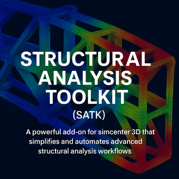
Structural Analysis Toolkit (SATK) is a powerful add-on for Simcenter 3D that simplifies and automates advanced structural analysis workflows. Designed for engineers who need to streamline simulatio
- Overview
- Seller Details
StuckPipePro calculates differential sticking force, drag, stuck chance along drill strings or casings for pick up operations.Its stuck mechanical analysis and a decision flow chart help users find th
141 Twitter followers
- Overview
- Seller Details
SurvOPT is a marine seismic project optimization solution that is designed for 2D, 3D and MAZ surveys and uses data about sail lines, obstructions, tides, currents, vessel performance and more to help
10 Twitter followers
- Overview
- Seller Details
We started TabLogs to change the game for the Geotechnical Engineering Industry. Our intuitive cloud-based borehole logging software removes a well known bottleneck within the Geotechnical Investigati
- Overview
- Seller Details
TADPRO is a comprehensive software package that accurately predicts torque and drag, removing several risks involved in drilling and completion operations. TADPRO helps users understand the visible, s
141 Twitter followers
- Overview
- Seller Details
Tecplot Focus enables you to quickly plot all your engineering and test data exactly the way you want.
3,558 Twitter followers
- Overview
- Seller Details
TerraSeis is an exploration informatics and data management solution that provides Data viewing, document imaging, and allows you to locate lines to help manage advantage and productivity.
- Overview
- Seller Details
TomoPlus is a near-surface solution package that is designed to obtain accurate near-surface velocity models and derive long and short wavelength statics solutions to help with the seismic data proces
- Overview
- Seller Details
TomoXPro is a crosshole software package that includes crosshole survey design, model building and modeling, data pre-processing, and more with capabilities you need for performing your project.
- Overview
- Seller Details
With TotaLand, you can log on from any internet connection and have all of your work at your fingertips – no more tracking down people to get updates.
2,989 Twitter followers
- Overview
- Seller Details
Trinity migration is a solution that controls the fractionation of hydrocarbon composition during migration.
- Overview
- Seller Details
UBDPRO models the complex hydraulics for compressible fluids including air, mist, foam and 2-phase fluids. This software model is used to optimize gas and liquid injection rates in order to control bo
141 Twitter followers
- Overview
- Seller Details
Underground Mining Metals Software is 100% script-free, and made up of pre-defined logic, which, when combined with the tacit knowledge of mining engineers, automatically determines what is practicall
- Overview
- Seller Details
Vecon is a 2D/3D VSP and surface seismic design and modeling system that makes completion of a variety of jobs with features to help manage efficiency.
- Overview
- Seller Details
Using Checkshot Velocity provides one with a virtual map database search engine or a text based database search engine. You can instantly search any area for the velocity surveys you need.
- Overview
- Seller Details
The VISAGE finite-element geomechanics simulator enables you to plan for and mitigate risks by modeling problems before they occur.
- Overview
- Seller Details
WinLoG Boring and Well Logging Software is a boring and well logging software that provides data that can be displayed in the field then transferred to your desktop for a professional full colored lo
49 Twitter followers
- Overview
- Seller Details
WinTrack is a solution that scans hard copy data and vectorizes the waveform of the original traces providing you with a range of data processing options, up to and including migration.


